
When the Parkway cut through town, Part 2
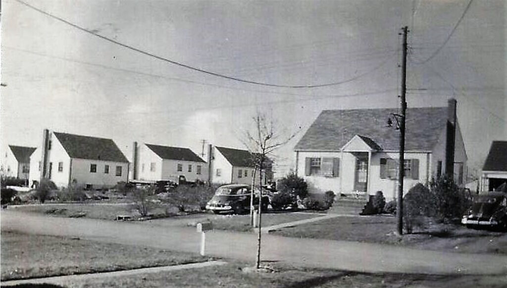
The residential southside of Kenilworth bore the brunt of the Parkway cutting through town. Many of those homes moved were from the Oak Knolls section of town – roughly the area west of Michigan Ave., then south of Bloomingdale Ave. to Fairfield Ave. A good number were cape cod homes built in 1940-41 that had to be taken away in 1949 and 1950. A bunch were placed on empty lots along Cranford, Faitoute, and Quinton Aves. These relocated cape cods are still identifiable today by the fact that those homes had a front door with double windows on each side of the entry door. Homes on Michigan, Vernon and Union avenues also were uprooted. To help assure that there were sufficient lots in the area to relocate homes, Kenilworth acquired some land on Cranford Ave. from Cranford.
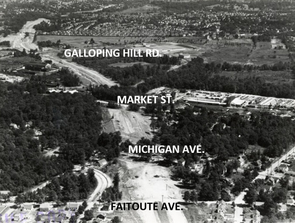
In this aerial photograph of nearly 75 years ago, four streets running left to right are identified from top to bottom of the aerial photo: (1) Galloping Hill Rd., (2) Market St., (3) Michigan Ave., and (4) Faitoute Ave. At bottom left, the curved street is Bloomingdale Ave.
At bottom right on a diagonal is Fairfield Ave.
Research provided by Walter E. Boright, Ed. D., historian, and Historic Signs, Inc. Appreciation to Luke Allocco for obtaining NJ Department of Transportation file photo. Persons with inquiries about this article or other aspects of Kenilworth history may contact Dr. Boright at drbori@aol.comor 908-256-5200.